A single point of contact
for your 3D scanning projects
Effective 3D survey interventions
Rely on survey protocols integrating the 3D scanners most suited to your needs, including dynamic scanners, allowing Increase your pace without compromising on data quality.
Thanks to this innovative equipment, we are in a position to considerably reduce the time required for the 3D survey, which translates into significant efficiency gains allowing to:
- Minimize the disruption that may be caused by the survey intervention
- Reducing costs of capture
- Manage large-scale projects under tight deadlines

Digitization protocols personalized
After a detailed analysis of your project, we develop a multi-technology survey plan that integrates the best available solutions, such as static scanners, dynamic devices and drones.
By deploying such protocols, we match the highest-performing equipment to your specific requirements, the intended use of the deliverables, and the specific characteristics of your buildings..

Protocols of multi-technology survey, allowing scanning time to be significantly reduced.

Benefit from survey protocols and standardized deliverables, for all your projects, wherever they are.

A quick and effective response, with international coverage, to meet our clients' needs wherever they are.
A responsive and standardized survey service on an international scale
Our agencies, ideally distributed across the globe, are ready to meet your needs, no matter where you are. With a single dedicated point of contact, we support your projects across all of France, Spain, and Europe.
We guarantee standardized protocols and deliverables, along with optimal responsiveness for all your requests.

The advantages of multi-technology protocols
relevés multi-technolgies
An ability to adapt the 3D scanning protocol perfectly to the specifications of the project and to the specificities of the buildings.
The guarantee of conduct a comprehensive data acquisition, covering all areas of the building.
The deployment of an effective survey protocol, without compromise between speed of acquisition and precision.
A single survey : the possibility of obtaining multiples deliverables
Based on a single survey, we are in a position to gather all the essential data that will make it possible to produce a variety of complementary deliverables adapted to your projects. This approach helps us to ensure that every aspect of your project is taken into account, thus offering a complete and tailor-made solution.


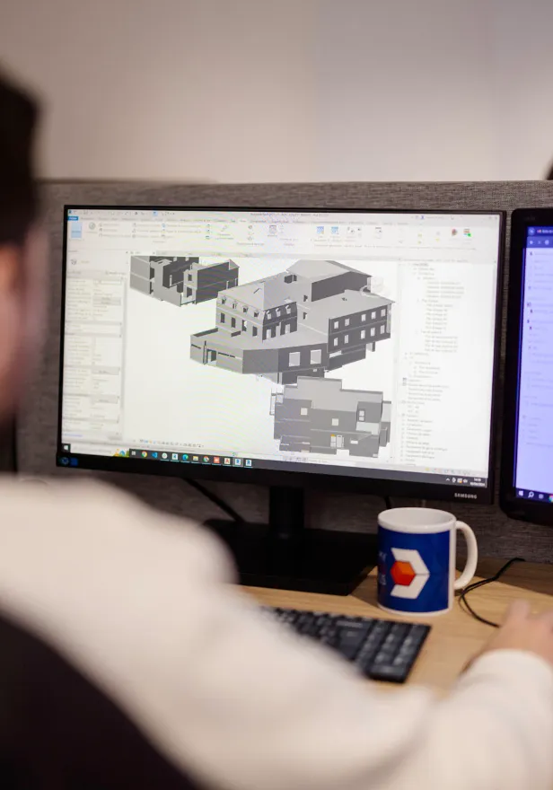
3D/BIM models
Modelled using a scan-to-bim process, and exported in your requested format (.RVT, .IFC, .STP, etc).

Virtual visit
The data is accessible via our web platform, and based on 3D data captured by our scanners.
Why work together ?


Multidisciplinary expertise focused on 3D, building, industry and BIM Management.

Project monitoring carried out by our BIM coordination team.

All of our deliverables are covered by our 10-year warranty.

An in-depth study of your digitization project to define the appropriate protocols and deliverables.
The progress of your digitization projects
Study of your project
Understanding your needs, uses, and studying the buildings concerned by your project.
Framing of expected deliverables
Common framing of expected deliverables, to ensure that they are aligned with your objectives and uses.
Definition of the survey protocol
We select the most suitable survey solutions for your project (static and dynamic scanners, drones, total station).
Survey intervention
3D scanning operation on site, following the protocol established to minimize the disruption of your operation.
Post-processing of captured data
Calculation, cleaning and assembly of point clouds and various data collected on site.
Production of deliverables
Creation of deliverables (2D plans; 3D/BIM model); virtual visit; point cloud) according to the specifications.

"The collaboration with My Digital Buildings gave us complete satisfaction, both in terms of mastery of survey and modeling techniques and project management.
The participants were able to embrace our experimental approach to propose innovative solutions while remaining operational."
“My Digital Buildings’ intervention made it possible to scan more than 70,000 m² in a few weeks, providing a precise point cloud and a 360° tour accessible to all stakeholders involved in the transformation, operation and maintenance of the station concerned by our project.”
Let's study your project together
Contact us, we will study your project to provide you with an estimate as soon as possible
Contact us


Q&a
Any questions you'd like answered?
Contact usWhat are the key steps in a 3D scanning project?
We identify 5 key steps in the course of a digitization project:
- The study of needs and the choice of adapted deliverables;
- The choice of 3D scanning solutions, according to the defined deliverables and the specificities of the concerned buildings;
- The study of plans and the definition of a digitization kinematics;
- On site, the preparation and digitization of areas;
- Post-processing and exploitation of captured data.
To find out more, we detail each of these steps in this article: “The key stages of a 3D scanning project”.
What is “Scan to BIM”?
This methodology makes it possible to rely on an imprint of reality with centimetric precision for CAD/BIM modelling.
To find out more, we detail the different steps of a Scan-to-BIM method in this article “The scan to BIM: from the point cloud to the digital BIM model”.
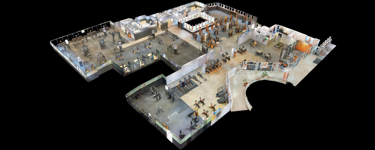
What is a point cloud?
The point cloud of a building is a real 3D footprint of the building. Technically, it is generated using LiDAR sensors, which lasergrammetry solutions are equipped with.
These sensors emit a laser beam that scans the environment until obstacles (object, wall, structure, etc.) are detected. The distance to each obstacle is then analyzed, in order to position a point in space. Repeating this process makes it possible to create a point cloud.
During our projects, we deliver the file containing the point cloud in a format adapted to your uses (.rcp, .e57, .xyz).
To find out more, we invite you to discover our article explaining How to use a point cloud.
What 3D scanning solution should you choose?
The choice of scanning solutions will be directly linked to the final exploitation of the data (plans, BIM/CAD models, etc.), to your specifications and to the specificities of your buildings.
Each project must be studied individually, to discover the advantages of possible digitization solutions, we invite you to read our article “What survey solutions should you choose for your project? ”.
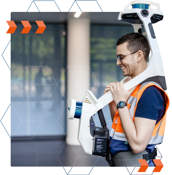
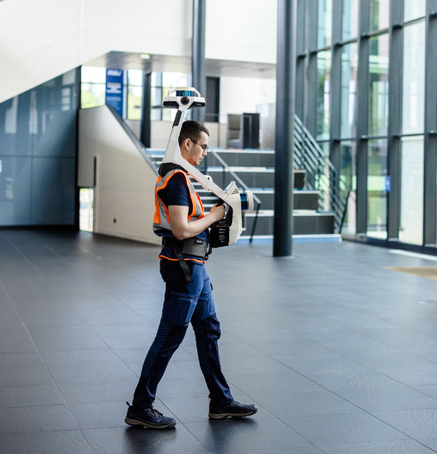
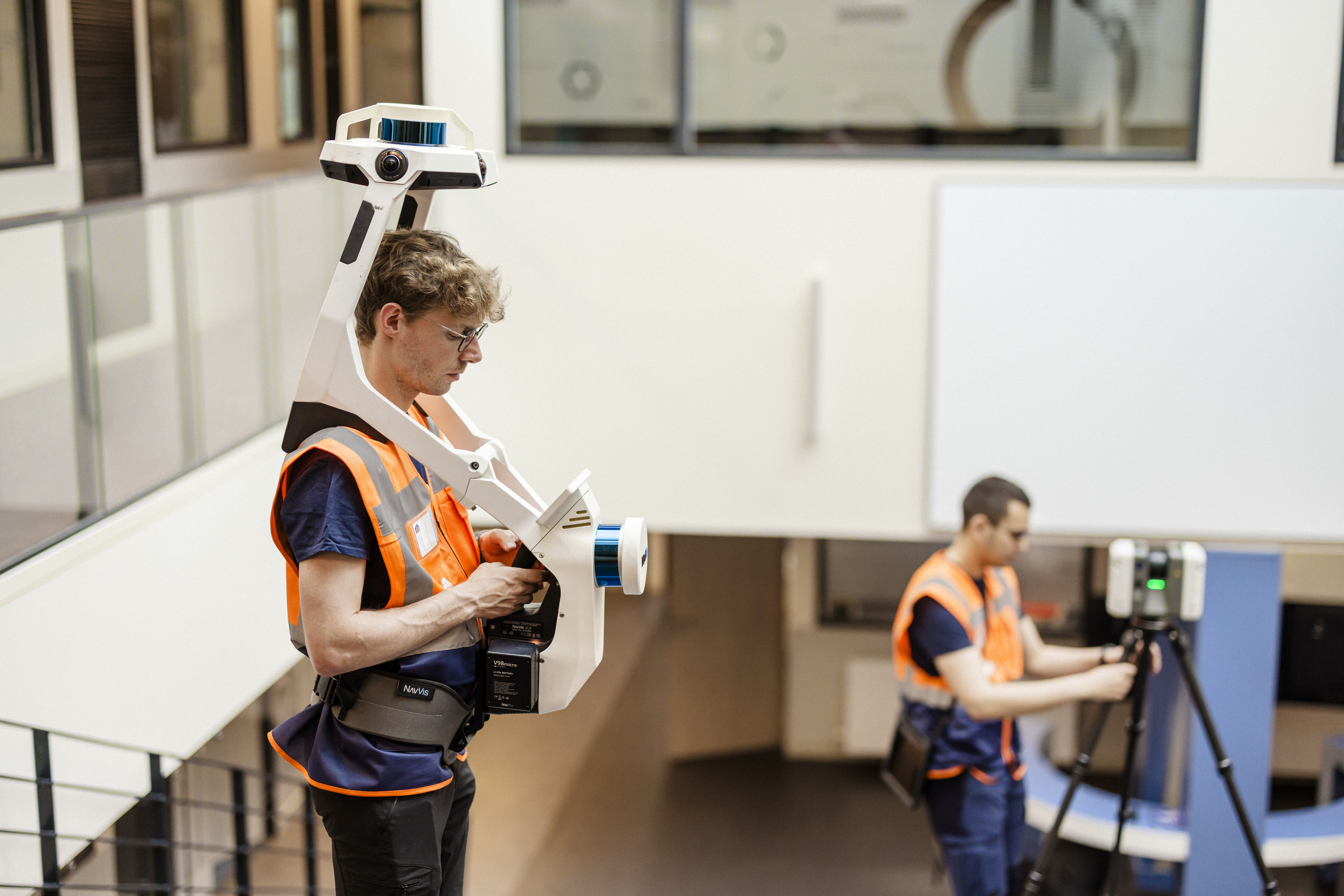
What is a mobile scanner?
Mobile laser scanners are measuring devices that allow you to scan an environment while moving. Thus, they offer a very high survey rate, which can go up to 12,000 m² per day.
The survey is therefore faster, without neglecting precision, which is why we put the mobile scanners at the center of our digitization protocol.
What is a static scanner?
A traditional and widely used scanning solution, static scanners are tripod-mounted measuring devices.
These solutions perfectly complement our mobile scanning solutions when it comes to identifying areas that are congested, difficult to access, or requiring increased precision. They also make it possible to capture high-density point clouds over a long range.
The manufacturers of static scanners the best known are Faro, Trimble and Leica.
What is a 3D scanner?
3D scanners are measuring devices based on LiDAR technology. They include one or more LiDAR sensors that emit a light beam that scans the environment horizontally and vertically to capture it in 3D.
They make it possible to generate a point cloud (raw 3D data), but also image and thermal data depending on the models.


