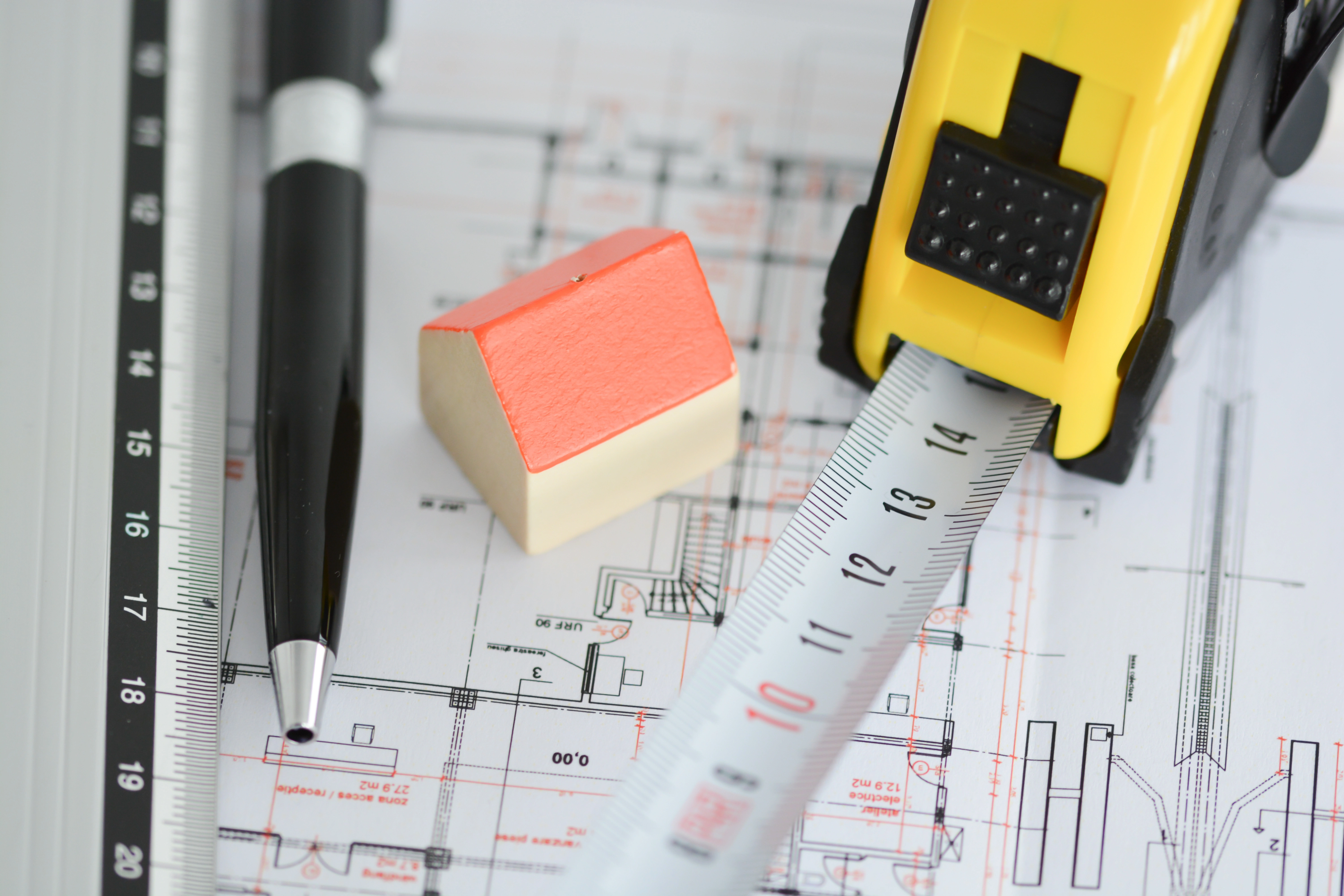
Why create or update your building plans?
To launch your projects on a healthy basis, reconstructing what already exists is essential. Our 2D plans Transcribe physical reality of your assets in accurate geometric data, eliminating the uncertainties associated with obsolete archives and securing your decision-making from the design phase.

The success of any renovation project relies on seamless coordination. By providing precise, up-to-date documentation, you offer architects, engineers, and contractors a single, shared resource for collaboration. This streamlines technical synthesis and minimizes design errors during the construction phase
Efficient building operations require documentation that reflects current conditions. By maintaining highly accurate plans and as-built drawings, you ensure a precise spatial inventory. This allows you to manage maintenance contracts effectively, plan specific works, and optimize space utilization on a daily basis
Plans that reflect reality, tailored to your business needs
Deliverables adjusted to meet your requirements
Your plan files are essential to your project's success. Defining every aspect clearly is crucial for anticipating challenges and ensuring effective coordination.
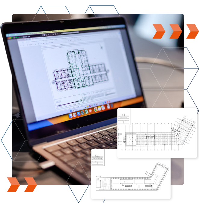
To provide a comprehensive understanding of your buildings, our 2D plans include dimensions, elevations, architectural and structural elements, and essential equipment—all rendered at your required scale.
Furthermore, we include any additional information specific to your needs, such as furniture, machinery, or specialized equipment. We believe a well-developed plan is the foundation of a successful project. That is why we take the time at the outset to identify your requirements, translating them into precise technical specifications delivered in your preferred file formats


High-precision 3D scanning at the core of your plans
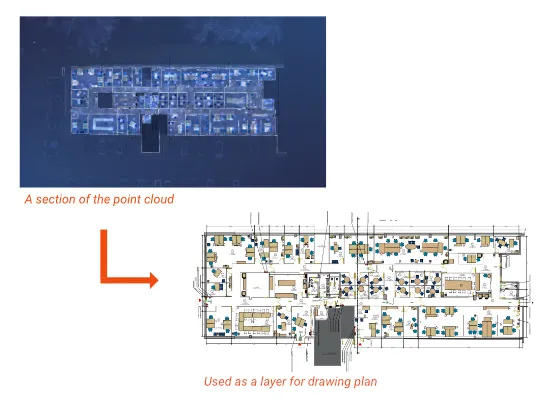
Unlike traditional methods, our 2D plans are developed directly from 3D laser-scanned point clouds.
This approach guarantees absolute fidelity to the reality on-site: every wall, opening, and structural element is positioned with millimeter precision. By eliminating manual measurement errors and oversights, you receive reliable deliverables that reflect the true condition of your buildings—not a theoretical version based on outdated archives.
A ”Scan to Plan“ drawing process
Representing the true footprint of the building, cross-sectional views of the point cloud act as a genuine 2D drawing overlay (or "calque") in Revit or AutoCAD. Using a point cloud as the foundation for producing 2D plans is referred to as the "Scan-to-Plan" process.
- Fast and reliable production of 2D plans.
- A versatile method applicable to all architectural views, including floor plans, façades, roof plans, and cross-sections (e.g., floor plans, façades, roofs, etc.).
- Better representation of environmental elements (e.g., furniture) and architectural details (e.g., moldings).
Nous adressons vos projets, où qu'ils soient
Avec un réseau d'agences stratégiquement implantées, nous vous offrons une couverture territoriale complète sur l'ensemble de la France.
Cette proximité nous permet de garantir une forte réactivité d'intervention pour tous vos projets, où qu'ils soient situés. Bénéficiez d'un interlocuteur unique pour assurer qualité et cohérence de vos plans sur l’ensemble de vos bâtiments.

A single survey : all documentation
necessary for your projects
Thanks to a single survey, we are able to gather all the necessary information to create a variety of plans, including floor plans, façades, and sections. This simplified process reduces the time and costs associated with collecting multiple sets of data, while ensuring optimal accuracy for every project.

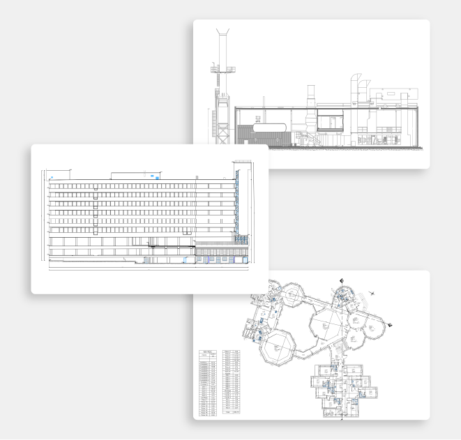
Floor plans
Detailed floor plans, including partitions, openings, sanitary facilities, ceiling heights, and dimensions.

Facade plans
Façade plans detailing openings, structures, chimneys, ornamentation, dimensions, and levels.

Roof plans
Plans detailing outdoor elements (e.g., chimneys and ridges) and interior features (e.g., beams and openings).
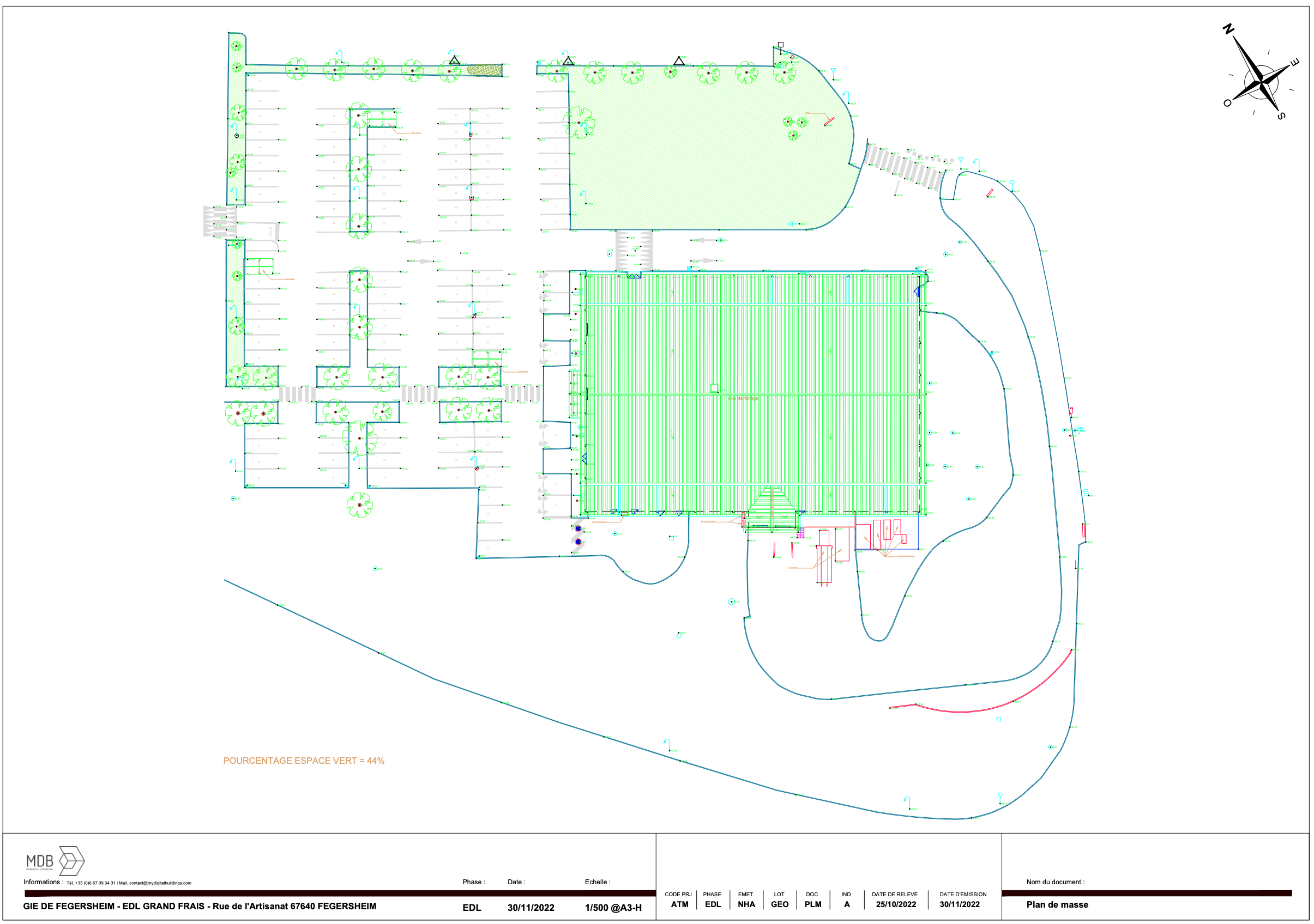
Mass plans
Production of mass plans and topographic plans based on the point cloud and external survey data.
The progress of your digitization projects

Study of your project
Understanding your needs, uses, framing the expected deliverables and studying the buildings concerned by your project.
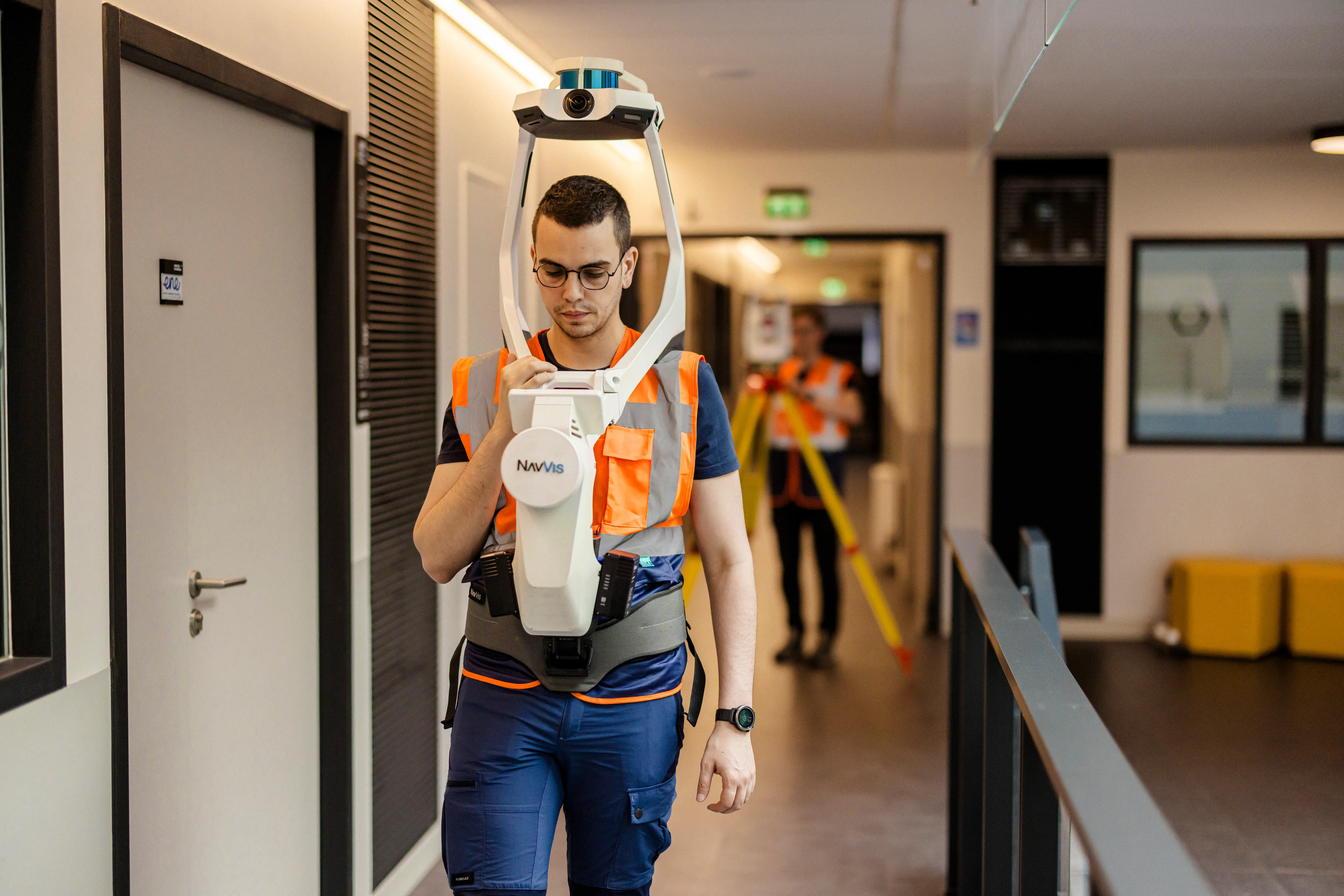
3D survey of the building
3D scanning site intervention by one or more surveying operators to generate a building point cloud.
Importing the point cloud into AutoCAD
Orientation, scaling and calibration on a reference system, reading volumes, levels and structuring elements and selecting information useful for the deliverable.
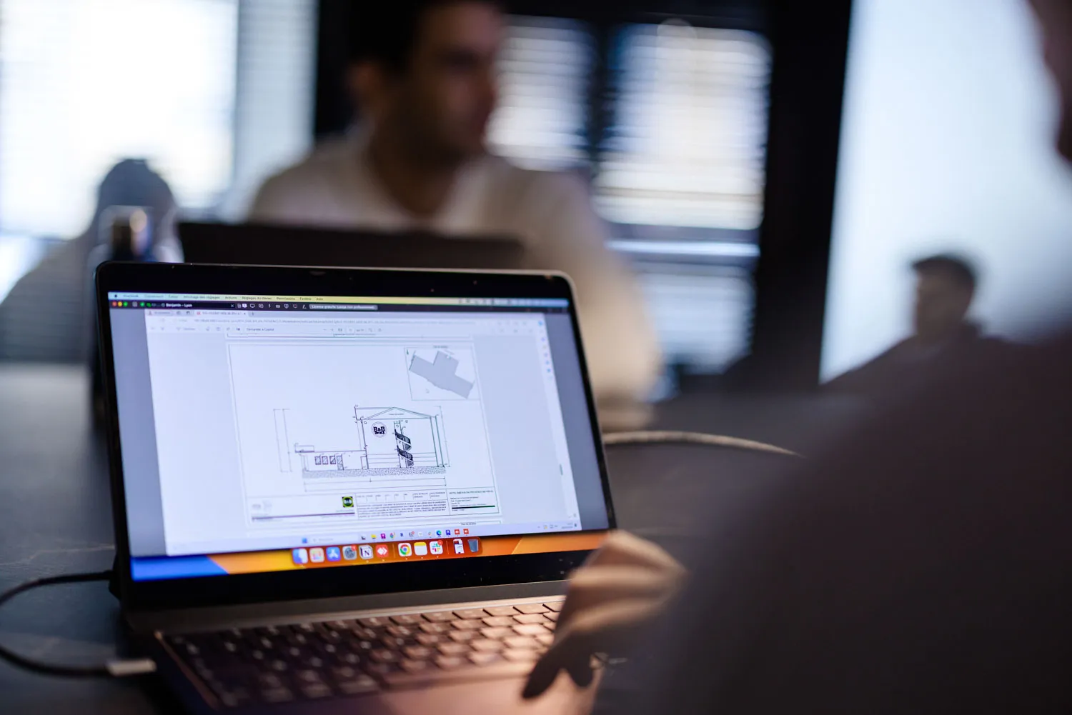
Drawing 2D plans
Production of the desired plans, layout of walls, partitions, partitions, carpentry, networks while respecting graphic conventions.
Quality control
Verification of ratings, levels and consistencies by using the point cloud, and virtual tour generated by our 3D scanners.
Final export and delivery
Layout, legend, cartridge, final export and delivery of your 2D plans.
"Collaborating with My Digital Buildings gives us a standardized operating model nationwide, with a single, trusted contact for surveying our buildings and obtaining reliable deliverables for our projects"
"Our collaboration with MDB allowed us to adapt our approach to our clients' surveys and modeling of buildings and workspaces.
Beyond the responsiveness of the MDB teams and their ability to find suitable solutions, the processes used save considerable time and provide high-quality results.
We look forward to continuing our partnership throughout France."
They trust us
Let's study your project together
Contact us, we will study your project to provide you with an estimate as soon as possible
Contact us


