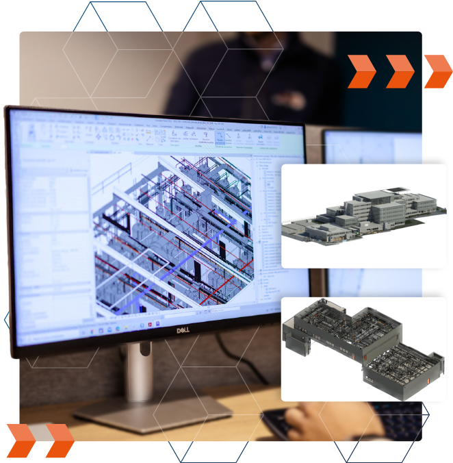
From point clouds to digital models

A modeling process in "Scan to BIM", guaranteeing a faithful representation of the reality of your buildings.

A modeling managed by a team of experts in building and BIM management, ensuring the production of a deliverable aligned with your business uses.
Detailed understanding of your use cases to ensure deliverables meet appropriate geometric and informational detail requirements.
A single point of contact
for your 3D scanning projects
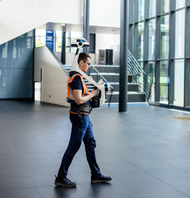
Effective 3D survey interventions
Rely on survey protocols integrating the 3D scanners most suited to your needs, including dynamic scanners, allowing Increase your pace without compromising on data quality.
Thanks to this innovative equipment, we are in a position to considerably reduce the time required for the 3D survey, which translates into significant efficiency gains allowing to:
- Minimize the disruption that may be caused by the survey intervention
- Reducing costs of capture
- Manage large-scale projects under tight deadlines
A responsive and standardized survey service on an international scale
Our agencies, ideally distributed across the globe, are ready to meet your needs, no matter where you are. With a single dedicated point of contact, we support your projects across all of France, Spain, and Europe.
We guarantee standardized protocols and deliverables, along with optimal responsiveness for all your requests.

A modeling process ”Scan to BIM“
reliable for your projects
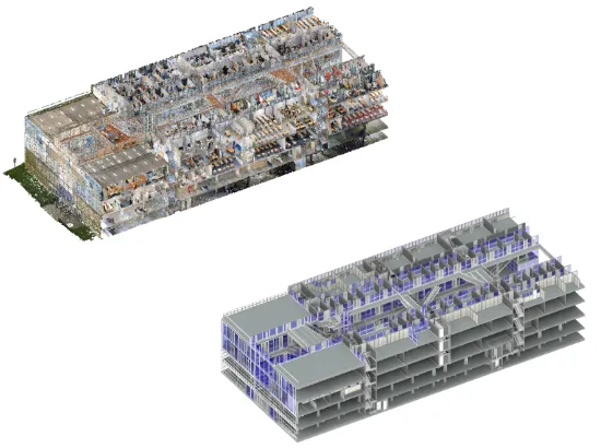
As part of our modeling projects, we use the point cloud as the modeling layer to ensure the production of an accurate 3D model (the Scan-to-BIM process).
Point clouds, the raw data collected by 3D scanners, represent a true 3D fingerprint of the buildings—including architectural and structural elements—and all their internal components (MEP/HVAC elements, etc.).
By adhering to this modeling process, building elements are represented with exceptional precision.
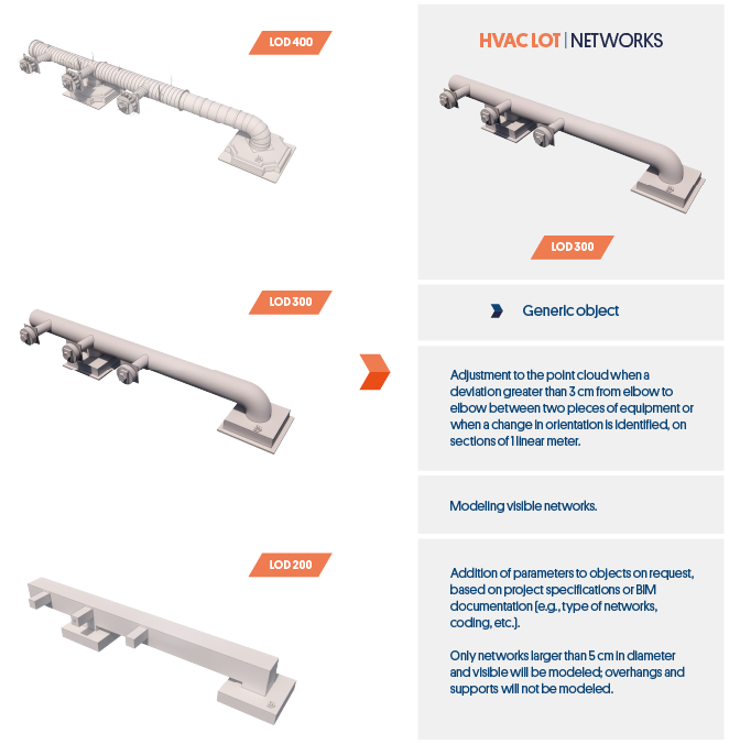
An aligned BIM model
to you needs
At the start of the project, we study your objectives to define the actionable deliverables in your business uses.
To do this, the modeling will be carried out using a structuring clear (data tree; georeferencing; etc.), and levels of detail geometric and informative (LOD/LOI) pre-defined for each lot represented.
Benefit from continuous
quality control
Throughout the modeling process and prior to the final delivery, the point cloud is exploited to carry out controls of geometric conformity of the model.
During these checks, the point cloud is compared to the 3D model to identify the geometric differences between the modeling and the real one.
This method makes it possible to tend towards a precision by plus or minus 1 cm (to plus or minus 2 cm for complex objects) compared to the surveys carried out.

They trust us
"We were fully satisfied with our collaboration with My Digital Buildings.
Their responsiveness, the quality of the 3D surveys, and the reliability of the deliverables greatly facilitated our monitoring and planning work."

“The collaboration with My Digital Buildings has brought us full satisfaction with the mastery of techniques for surveying, modeling and structuring the information in the model.
The stakeholders were able to take ownership of our experimental approach in order to propose innovative solutions while remaining operational.”
Let's study your project together
Contact us, we will study your project to provide you with an estimate as soon as possible
Contact us


Would you like to collaborate on a project?
Our team is ready to support you at every stage of your digitization journey. We offer customized solutions and expert advice designed specifically for your needs, guaranteeing your project's success from initial concept to final deployment.


